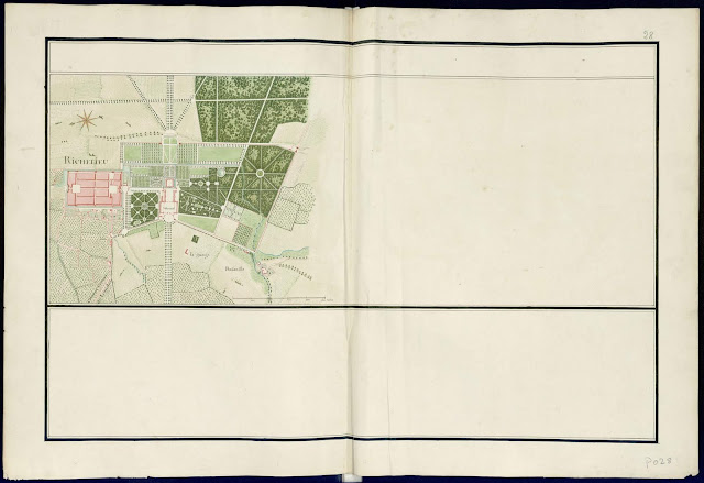
The so-called 'Cartes de Trudaine' are a collection of three thousand maps of the various regions of France assembled by the metropolitan Ponts et Chausées in the years 1745 -1770.
The Atlas of Highways in France, called the 'Atlas Trudaine', constitute a unique and consistent sixty-two volume collection of Atlases of maps, in all totalling over 3000 carefully hand drawn sheets, each tinted in watercolor. They are held in the French National Archives (formerly the Centre Historique des Archives Nationales (CHAN)) in Paris. Made between 1745 and 1780 on the orders of Charles Daniel Trudaine, the Director of Ponts et Chausées, they show all bridges and roads, existing and proposed, with their immediate surroundings that were within the twenty-two Généralités des Pays d'Élections governed by royal Intendants. The Pays d'États (Burgundy, Provence, Languedoc and Brittany) and the Pays d'Imposition (border regions conquered by Louis XIV) are excluded from coverage of the maps, but the Généralité of Metz has three atlases and Haut-Cambrésis three atlases as well.
These atlases are a valuable and highly useful documentation of the eighteenth-century French landscape. They include representations of populated places, woods, streams and roads, isolated buildings (crosses, shrines, castles, mills, factories, quarries ...), and the the sites of all works of art close to roads or actually built upon them.
Below, we show three of these maps of the region around Richelieu, it being located in the Généralité of Tours.
- The Cité Idéale and château de Richelieu
- The road from Richelieu to Champigny-sur-Veude
- The town plan of Champigny-sur-Veude
The maps show the state of the locality in the lifetime of the third duc de Richelieu, Maréchal Armand de Vignerot du Plessis
As these maps are a record of roads and bridges between various locations, they cannot sustain the etiquette of 'North upwards'; In the Richelieu map East is upwards; in the road to Champigny the East remains upwards; in the Champigny map South is upwards.
 |
| The town and castle of Richelieu |
 |
| the five kilometre road between Richelieu and Champigny-sur-Veude |
 |
| The town of Champigny-sur-Veude |
 |
| the Généralités of 18th century France |
***
this post dedicated to Liezel, a researcher for criticalproductive at Cornell University, with many thanks for the inspiration...
***


No comments:
Post a Comment